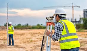
Civil surveyor in Rawalpindi
The Civil Surveyor Training Program is designed to equip individuals with the skills and knowledge necessary to excel in the field of land surveying within the civil engineering domain. This comprehensive program covers a wide range of topics, including surveying techniques, geospatial technology, data analysis, and legal aspects of land surveying. Participants will gain hands-on experience with state-of-the-art surveying equipment and software, enabling them to accurately measure and map land features, analyze survey data, and contribute effectively to civil engineering projects.
Course Benefits:
- High Demand: Land surveyors are crucial for land development, infrastructure projects, urban planning, and more. This program opens doors to a rapidly growing job market.
- Diverse Opportunities: Graduates can work in various sectors, including construction, real estate, government agencies, and private surveying firms.
- Hands-on Experience: Practical training with modern surveying instruments and software ensures graduates are job-ready.
- Career Growth: As surveyors gain experience, they can advance to roles such as senior surveyors, project managers, or specialize in specific surveying areas.
- Contribution to Infrastructure: Surveyors play a vital role in shaping communities by providing accurate data for sustainable development.
Course Learning Outcomes
By the end of the Civil Surveyor Training Program, participants will be able to:
- Understand the fundamental principles of land surveying and geospatial technology.
- Proficiently operate surveying instruments, including total stations, GPS receivers, and laser scanners.
- Conduct precise field measurements for topographic, boundary, and construction surveys.
- Analyze survey data using software tools to create accurate maps, plans, and reports.
- Apply legal and ethical considerations related to land boundaries, property rights, and land use regulations.
- Collaborate effectively with engineers, architects, and other professionals in civil engineering projects.
- Demonstrate proficiency in communicating survey findings through visual representations and technical documentation.
Course Study Units:
Introduction to Land Surveying
- Historical overview of land surveying
- Role of surveyors in civil engineering projects
- Surveying terminology and concepts
- Basics of geospatial technology
Surveying Instruments and Techniques
- Total stations and theodolites
- Global Positioning System (GPS) and satellite technology
- Laser scanning and LiDAR technology
- Measurement error reduction techniques
Field Surveying Practices
- Topographic surveys and contour mapping
- Boundary surveys and legal considerations
- Construction staking and layout
- Data collection and field note documentation
Geospatial Data Analysis
- Geographic Information Systems (GIS) principles
- Data processing and analysis using GIS software
- Creation of digital maps and spatial databases
- Visualization and presentation of survey data
Legal and Ethical Aspects of Surveying
- Land ownership and property rights
- Easements, right-of-ways, and land use regulations
- Adverse possession and land title issues
- Ethical considerations in surveying practice
Communication and Project Collaboration
- Effective communication with project stakeholders
- Collaboration with engineers, architects, and urban planners
- Technical report writing and documentation
- Visual representation of survey results
Entry Requirements:
- High school diploma or equivalent
- Basic understanding of mathematics and geometry
- Proficiency in using computers and basic software
- Strong attention to detail and problem-solving skills
- Good communication skills for effective collaboration
Future Progressions:
Upon successful completion of the Civil Surveyor Training Program, graduates can pursue various career paths and educational opportunities:
- Land Surveyor: Start a career as a surveyor in construction, land development, or geospatial technology companies.
- GIS Specialist: Specialize in Geographic Information Systems (GIS) to manage, analyze, and visualize spatial data.
- Project Manager: Gain experience and move into project management roles overseeing surveying projects.
- Higher Education: Pursue further education in civil engineering, land management, or geospatial sciences.
- Professional Certification: Obtain certifications from relevant bodies like the National Society of Professional Surveyors (NSPS) for career advancement.
Conclusion:
the Civil Surveyor Training Program offers a comprehensive curriculum that prepares individuals for a rewarding career in the dynamic field of land surveying. With a strong foundation in surveying principles, cutting-edge technology, and practical skills, graduates will be well-equipped to contribute to the development of modern infrastructure and sustainable land use. This program not only opens doors to diverse employment opportunities but also provides a platform for ongoing professional growth and specialization.